Filtered by Category:Mapmaking(Show All Categories)
Articles
6 articles

Establishing the U.S. Coast Survey
This May 2024 article examines the origins of the U.S. Coast Survey and its first 60 years of operation. It provides an overview of the first two Superintendents of the Survey, Ferdinand Hassler and Alexander Bache, and how their leadership shaped the functions and output of the Coast Survey.
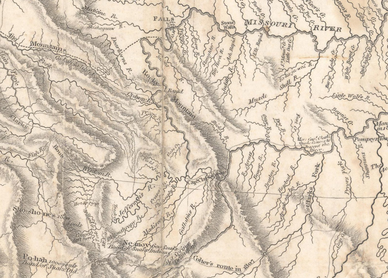
Lewis & Clark: Mapping the West
This May 2023 article gives an overview of the Lewis & Clark expedition through the western United States, with particular attention to the maps and cartographic tools they used on their journey.

A New View on the First Lithographed Map in the United States
This April 2021 article is by guest contributor Jim Kissko, founder of Camelot Books. This article makes the case for the first map that was lithographed and published in the United States.
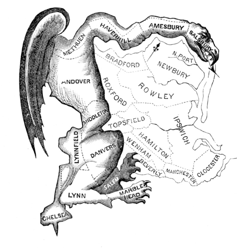
Map Manipulations: A Brief Perspective on Gerrymandering
This July 2017 article gives a brief history of gerrymandering - find out how it started and how it has evolved over time.
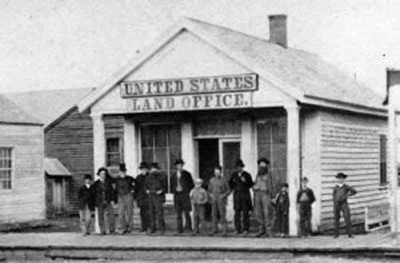
The Early United States Land System
This article from October 2016 gives a history of "The Early United States Land System."

A Brief History of Surveying Tools in North America
This article from October 2015 overviews "A Brief History of Surveying Tools in North America."
6 articles