Subject: Indian Ocean
Period: 1715 (published)
Publication: Atlas de la Navigation et du Commerce
Color: Hand Color
Size:
21.1 x 17.4 inches
53.6 x 44.2 cm
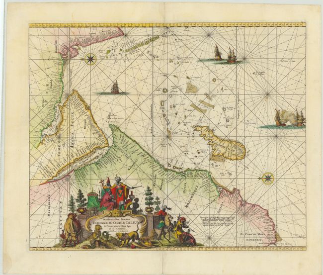
This decorative sea chart details the Indian Ocean from the Cape of Good Hope to Kanyakumari (C. Comorin) in India, and includes the Arabian Peninsula, Madagascar, the Maldives, and many smaller islands. Two compass roses orient north to the left, and detail is confined to the coasts with numerous place names. The interior of Africa contains an elaborate title cartouche featuring regional figures and animals, and the map is further embellished by several sailing vessels, with two engaged in battle. This map was first published by Frederick de Wit, circa 1675.
References: cf Norwich #256; cf Tibbetts, G.R. #129.
Condition: B+
A nice impression with minor soiling and some professionally repaired worm holes along the centerfold with image replaced in facsimile. There is one damp stain in left blank margin, far from map image.