Subject: World
Period: 1852 (circa)
Publication:
Color: Hand Color
Size:
28.4 x 15.7 inches
72.1 x 39.9 cm
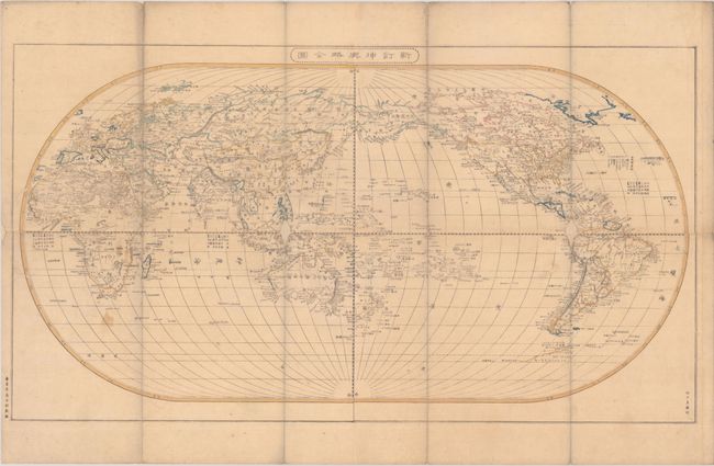
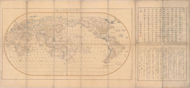
This Japanese woodblock map presents the world on an oval projection with Japan at center. The United States is shown extending to the Pacific Ocean and well into present-day British Columbia, reflecting outdated U.S. interests in the region. Mexico is still in control of the Southwest including Texas even though it was a U.S. state by this time. Australia is named New Holland. Countries are delineated in contemporary outline color, river systems are well documented, and explanatory notations appear throughout. The map is flanked by two panels of text at right, which explain, in part, that older maps included a sixth southern continent called Megala, but recent discoveries by western travelers have shown that this landmass did not exist. Engraved by Takeguchi Teisai and published by Shuzo Shibata. The full sheet with text measures 41.4 x 19.3". Folds into original paper boards with modern title pasted on top.
References:
Condition: B
A nice impression with small loss at three fold junctions along with some adjacent worm tracks that have all been professionally infilled with Japanese tissue. Light soiling. Stiff paper boards have minor wear.


