Subject: Gulf of Mexico & Caribbean
Period: 1783 (dated)
Publication: Robertson's History of America
Color: Hand Color
Size:
19.9 x 12.1 inches
50.5 x 30.7 cm
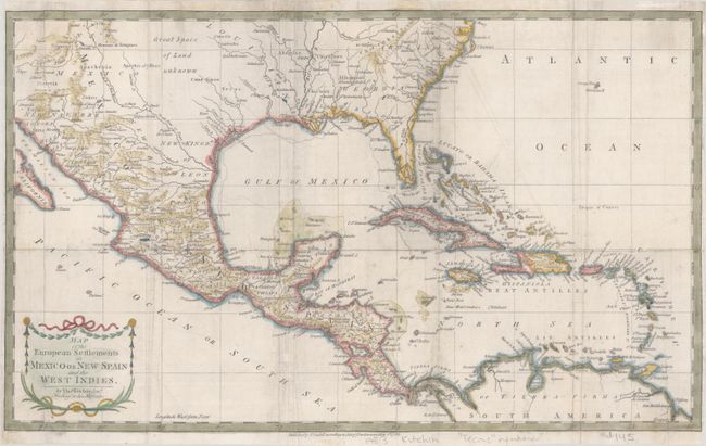
This detailed and expansive map covers all of the southern United States north to the Carolinas and Cape Henry. It continues west through the region labeled Great Space of Land unknown to the southern tip of Baja California. All of the Caribbean is shown, naming the Great Antilles, Cuba, and the Bahamas, with the Windward and Leeward together identified as the Caribbe Is. The map is filled with place names, rivers, and Indian tribes. Decorated with a delicate title cartouche.
References:
Condition: B
Issued folding and now flat with professional repairs to a 9" edge tear at top center, a 1" edge tear at top left, and a few fold separations at lower right. There is some minor extraneous creasing and remnants of old tape along the top edge on verso. Trimmed close to the border at left and right.