Catalog Archive
Auction 194, Lot 399

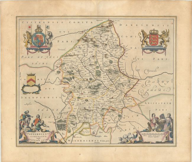
"Staffordiensis Comitatus; Vulgo Stafford Shire", Blaeu, Johannes
Subject: Western England

Period: 1645 (circa)

Publication: Theatrum Orbis Terrarum

Color: Hand Color

Size:
19.8 x 16.1 inches
50.3 x 40.9 cm
Download High Resolution Image
(or just click on image to launch the Zoom viewer)

This map of the county of Staffordshire is centered approximately on the city of Stafford. The map includes 5 elaborate cartouches featuring coats of arms, farm maidens with their harvest and livestock, and a surveyor, and a man on horseback. Latin text on verso, published between 1645-46.

References: Van der Krogt (Vol. II) #5350:2.

Condition: B+

A dark, early impression on a watermarked sheet with contemporary outline color in the map and later color in the decorative elements. There is light toning that is more prominent in the margins and scattered foxing.

Estimate: $300 - $375

Sold for: $220

Closed on 9/13/2023

Archived