Catalog Archive
Auction 197, Lot 512

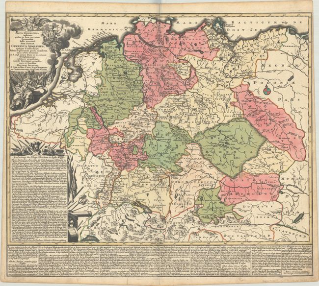
Map Detailing the Thirty Years' War

"Mappa Geographica Indicans, Quibus in Locis per Totam Germaniam Bello Tricennali Rex Sueciae Gustavus Adolphus...", Seutter, Matthias
Subject: Central Europe

Period: 1730 (circa)

Publication:

Color: Hand Color

Size:
22.4 x 19.4 inches
56.9 x 49.3 cm
Download High Resolution Image
(or just click on image to launch the Zoom viewer)

This detailed map focuses on the theater of war during the Thirty Years' War, and in particular battles involving Gustavus Adolphus, King of Sweden, who died in the Battle of Lützen. The map extends from the North Sea to the Baltic Sea, and as far south as Lake Geneva. Battle sites are identified with crossed swords, and several panels of text describe the major battles. The title cartouche features Fame, Justice, and a soldier with weaponry.

References:

Condition: A

A dark impression with full contemporary color, a few minor spots in the image, and marginal soiling.

Estimate: $180 - $210

Sold for: $180

Closed on 4/24/2024

Archived