Subject: Northwestern Germany, Rhine & Meuse Rivers
Period: 1641 (circa)
Publication:
Color: Hand Color
Size:
20.1 x 15.2 inches
51.1 x 38.6 cm
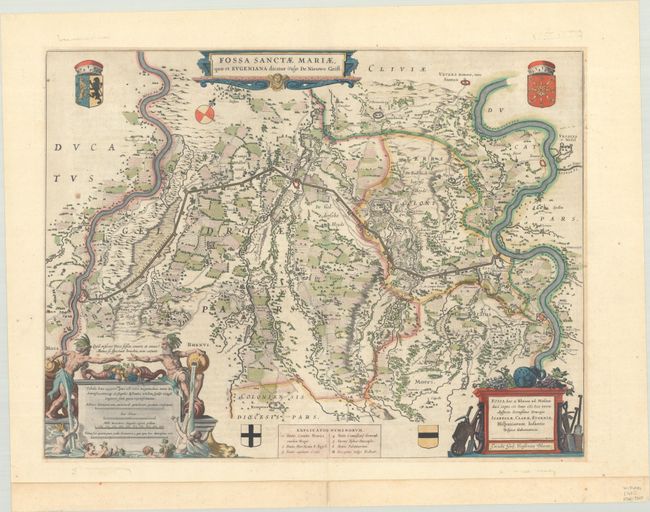
This wonderful chart depicts the planned route of the Fossa Eugeniana, a canal intended to connect the Meuse and Rhine Rivers. This canal was planned during a ceasefire period in the Eighty Year's War when the Spanish government abandoned their military efforts to assert their authority in the Netherlands in favor of a plan to disrupt the Dutch Rhine trade. The canal was called Fossa Eugeniana, named after the Spanish governess at Brussels, Isabella Clara Eugenia, daughter of Philip II. The channel from Rheinsberg to Venlo included a defense wall with 24 fortified redoubts, which are illustrated here. The project began in 1626 and was abandoned in 1630 after repeated attacks from the Dutch and problems with financing. The map is finely detailed - right down to the tiny churches and fields, and decorated with coats of arms and elaborate cartouches featuring river gods, grapes, and mining tools. German text on verso, published between 1641-70.
References: Van der Krogt (Vol. II) #3790:2.2.
Condition: B+
A dark impression with very light mat burn, a few spots of foxing in the image, and the bottom edge of the sheet reinforced with old paper.


