Subject: Exploration & Surveys, East Indies, Japan & Africa
Period: 1746 (published)
Publication:
Color: Black & White
Size:
8.3 x 10.4 inches
21.1 x 26.4 cm
This is a very nice example of volume two of Prevost's history of voyages, with maps by Jacques Nicolas Bellin. This is the 1746 "Nouvelle Collection" published in Paris. The volume is divided into three sections and describes the British voyage to the East Indies, as well as various expeditions to Africa and the surrounding islands, including the Canary and Cape Verde Islands.
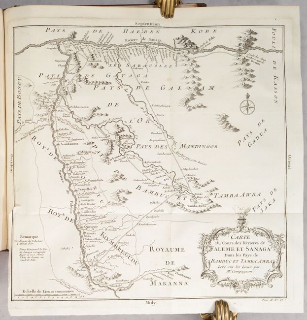
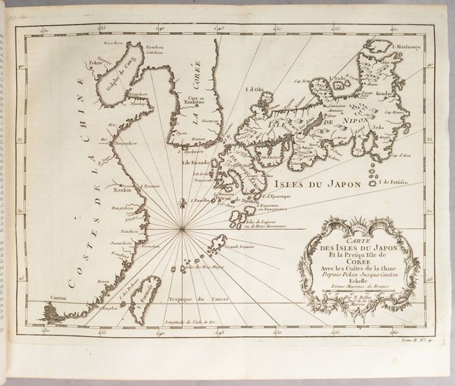
Included is a folding map entitled Carte du Cours des Rivieres de Faleme et Sanaga Dans le Pays de Bambuc et Tamba Awra, which is an interesting map of the important Bambuk gold mining region lying between the Senegal and Faleme Rivers with various kingdoms including the Royaume de Bambuc. Trade routes, villages and gold mines are all well delineated. Another map, Carte des Isles du Japon et la Presqu Isle de Coree, Avec les Costes de la Chine Depuis Pekin Jusqu'a Canton extends to Korea, a portion of the coast of China to Canton, the Ryukyu Islands and Taiwan (Formosa). It is based on the cartography of Kaempfer-Scheuzer. The full list of maps:
Carte du Golphe de Bengale. (10.6 x 8.6”)
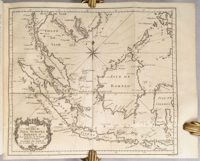
Carte des Isles de Java, Sumatra Borneo &a. (11.3 x 9.8”)
Carte des Isles Philippines Celebes et Moluques. (6 x 8.6”)
Carte des Isles du Japon et la Prequ’Isle de Coree. (11.2 x 8.3”)
Carte des Costes de Cochinchine Tunquin. (5.7 x 8.2”)
Carte des Isles Canaries. (11 x 8”)
Carte de l’Isle de Teneriffe. (5.8 x 8.1”)
Carte des Isles de Madere et Portosanto. (8.7 x 6.2”)
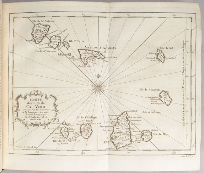
Cartes des Isles du Cap Verd. (11.1 x 8.4”)
Plan de la Ville et des Forts de S. Jago. (5.7 x 8.2”)
Isle de May [on sheet with] Veue de l’Isle S. Jago [and] Le Havre de Praya. (8.2 x 5.7”)
Plan de la Baye de l’Isle de St. Vincent. (5.9 x 8”)
Carte de la Coste Occidentale d’Afrique. (5.9 x 9”)
Carte d’une Partie de la Coste d’Afrique. (5.7 x 9.2”)
Plan de la Baye et Isle d’Arguim. (8.2 x 5.7”)
Plan du Fort d’Arguim. (5.7 x 8”)
Plan de Portendic, Appelle Aussi Portudaddi ou Penia. (5.8 x 8.2”)
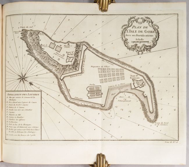
Plad de l’Isle de Goree avec ses Fortifications. (10.8 x 7.8”)
Plan de l’Isle de Goree, sur les Desseins du Sr. Compagnon. (14.3 x 7.8”)
Carte des Pays Voisins des Riv. eu Sanaga et Gambra. (6.1 x 8.6”)
Cours de la Riviere de Sanaga ou Senegal. (11.3 x 8.6”)
Carte de l’Entrée de la Riviere de Sanaga ou Senegal. (6 x 8.7”)
Isle Saing Louis [on sheet with] Plan du Fort St. Joseph. (6.3 x 8.8”)
Plan du Fort St. Louis dans l’Isle de Sanaga ou du Senegal. (11.9 x 8.1”)
Cours de la Riviere de Senegal Depuis son Embouchure jusqu’au Desert. (5.9 x 8.1”)
Cours de la Riviere de Senegal Depuis le Desert jusqu’a l’Isle de Mofil. (8.6 x 5.6”)
Carte du Cours des Rivieres de Faleme et Sanaga dans les Pays de Bambuc et Tamba Awra. (11.2 x 11.1”)
Coste d’Afrique et les Isles Comprises entre le Cap Rouge et la Riviere de Nunho. (10.3 x 8.1”)
Quarto. Title page; [6pp]; 654 pp.; 28 maps; 24 plates of illustrations; list of maps and plates. Hardbound in full calf with raised bands, gilt tooling and gilt title on spine; marbled endpapers; all edges red; original green ribbon page marker.
References:
Condition: A
A lovely example with crisp impressions on bright sheets. About a third of the maps have light toning or occasional foxing or soiling. The text is also clean and bright and the title page has light foxing. There is a dampstain that affects just a few scattered pages along the bottom edge. The binding is sound. The covers are scuffed and have bumped corners, and there is a bit of cracking along the spine.


