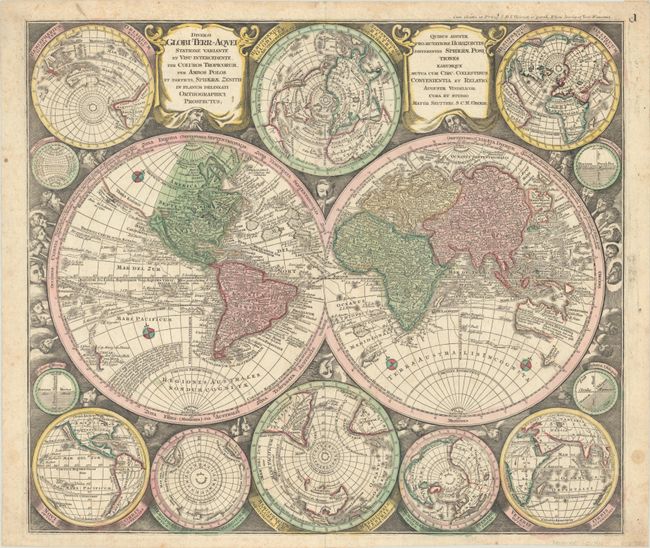
Subject: World
Period: 1742 (circa)
Publication: Atlas Novus
Color: Hand Color
Size:
22.8 x 19.6 inches
57.9 x 49.8 cm
This is one of the most graphic 18th century world maps. The bold engraving style follows Carel Allard's map of 1696 with the central twin hemisphere map surrounded by several smaller maps on various projections. The island of California is depicted five times on the sheet. In Asia, Japan is shown in a bizarre shape that incorporates a huge Terra Yedso (Hokkaido). The coastlines of Australia and New Zealand are beginning to take shape, and New Guinea is shown twice - once in each hemisphere. The map is filled with detail including the tracks of several explorers. A richly engraved background of clouds with numerous wind heads, lesser spheres and two cartouches complete the stunning composition.
References: Portinaro & Knirsch #119; Shirley (BL Atlases) T.SEU-2a #3.
Condition: B+
A crisp impression with full contemporary color on a bright sheet with light soiling and foxing that is mostly confined to the blank margins, as well as two tiny worm holes in the image that have been archivally infilled. There are small remnants of hinge tape on verso.