Subject: Western United States
Period: 1861 (circa)
Publication:
Color: Hand Color
Size:
10 x 12 inches
25.4 x 30.5 cm
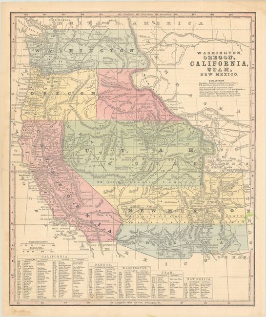
This map was issued on the eve of the Civil War and depicts the ephemeral Jefferson Territory along the eastern slope of the Rocky Mountains. This extralegal and unrecognized territory of the United States existed from October 24, 1859 until the creation of Colorado Territory on February 28, 1861. Naming a northern territory after a Southern President as the Civil War approached apparently did not sit well with Congress!
Cartographically, the map shows an evolving West with the “Proposed Territory” of Arizona occupying the southern part of New Mexico Territory, a possible reference to the Confederate Territory of Arizona. The map also depicts a large Nebraska Territory and an unnamed territory to the east of Oregon that became part of Idaho. Washington Territory extends to the Rocky Mountains and Utah Territory is in its largest configuration, stretching from Kansas to California.
References:
Condition: A
There are a couple of light stains and one tiny repaired tear in the left blank margin that just touches the border.