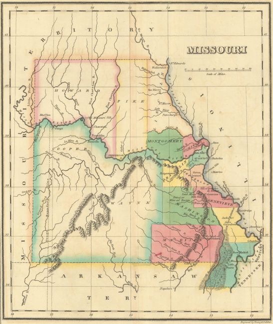
Subject: Missouri
Period: 1822 (circa)
Publication: A Complete Historical, Chronological, and Geographical American Atlas
Color: Hand Color
Size:
10.1 x 11.9 inches
25.7 x 30.2 cm
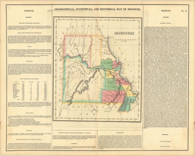
This is the first published map of Missouri as a state, and it is surrounded by text describing the boundaries, climate, rivers, lead mines, chief towns, religion, education, commerce, government, and history of the state. The map depicts 15 counties with virtually all settlement concentrated along the Missouri and Mississippi rivers. In the western portion of the state the Osage Boundary Line is shown, in reference to the Treaty of Fort Clark (1808) in which the Osage Nation ceded everything east of this line and north of the Arkansas River to the United States. A table at left breaks down the population of each counties whites, free blacks, and slaves, with a total state population of 66,586. On a full folio sheet (22.0 x 17.6") and engraved by Young & Delleker.
References:
Condition: B+
A sharp impression with contemporary color and light offsetting. There is light dampstaining along the edges of the sheet, entering the text at bottom center.