Subject: Waller County, Texas
Period: 1900 (dated)
Publication:
Color: Printed Color
Size:
26.6 x 44.6 inches
67.6 x 113.3 cm
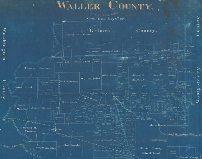
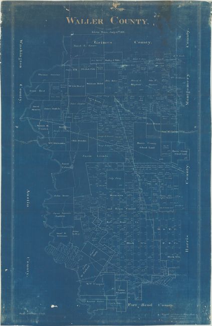
This blueprint map of Waller County, Texas was originally drawn and compiled by Herman Pressler at the Texas General Land Office in 1897 and copied here by J.W. Morris in 1900. It serves as a visual record of all property owners at the time, including numerous private citizens, railroad companies, and public lands. Several prominent Texas families are located on this map including the Austin family along the Brazos River, Perry family (descendants of Austin's sister Emily), and William Cooper, a member of the Old Three Hundred. Drawn using a Spanish scale of 2,000 Varas per inch (about 1 mile per inch). Waller County was named after Edwin Waller, the first mayor of Austin and a signer of the Texas Declaration of Independence.
References:
Condition: B
There are several short edge tears into the image at top, light dampstaining along the right sheet edge, and surface wear at top and bottom. A small hole is visible in a blank area above the bottom border and a second tiny hole is located above the title. The map has been stored rolled and does not lay flat on its own.