Catalog Archive
Auction 198, Lot 259

"Map of Washington Ter.", Page, H. R.
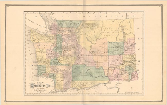
Subject: Washington

Period: 1883 (dated)

Publication:

Color: Hand Color

Size:
26.6 x 16.4 inches
67.6 x 41.7 cm
Download High Resolution Image
(or just click on image to launch the Zoom viewer)

This large map is a scarce issue of Washington Territory by the little-known H.R. Page & Co. firm of Chicago. Development is primarily along the coastline as well as along the railroads in the eastern portion of the territory. The center of the territory is occupied by the large Stevens, Douglas, Kittitass and Yakima counties. A note in Stevens County indicates lands "Reserved for Chief Moses and his people." An uncommon map issued 6 years before statehood.

References: Ristow, p. 443.

Condition: A

Contemporary color on a mostly clean bright sheet.

Estimate: $300 - $375

Sold for: $400

Closed on 6/19/2024

Archived