Subject: Gulf of Mexico & Caribbean
Period: 1860 (dated)
Publication: Atlas Spheroidal & Universel de Geographie
Color: Hand Color
Size:
20.1 x 13.3 inches
51.1 x 33.8 cm
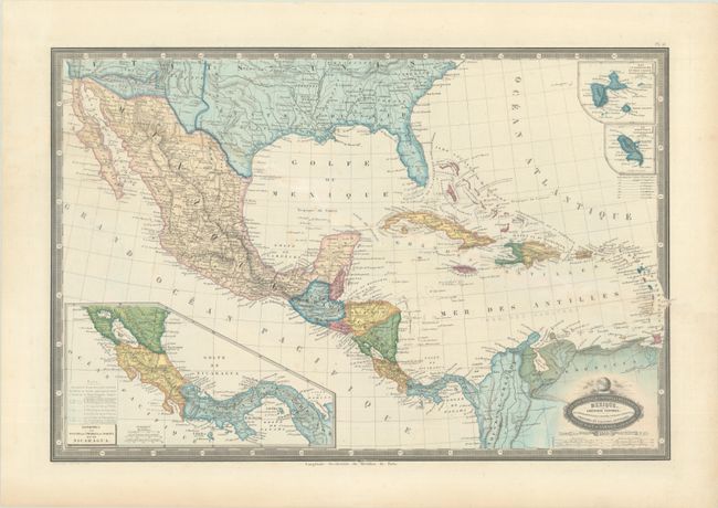
This handsome French atlas map shows the southern United States, Mexico, Central America, the Caribbean, and northern South America. Texas is depicted as part of the United States in a squat configuration. The territory covered in the Gadsen Purchase is delineated and labeled both Pimeria Alta and Arizona Territory. Various tribal names appear in the West, and the land north of Texas is called Terre. des Indiens. In Mexico, states are delineated by dotted line. At bottom left is an inset, Isthmes de Panama, de Chiriqui, de Darien, et de Nicaragua. Two smaller insets, showing Guadeloupe and Marie-Galante and Martinique, appear at top right. European colonial holdings are identified. Six distance scales appear below the title cartouche. Surrounded by a keyboard-style border.
Published in Paris by Renouard, F.A. Garnier's Atlas Spheroidal & Universel de Geographie is quite rare and sought-after for its elegant hand coloring, precise engraving, and decorative maps.
References: Phillips (Atlases) #836-51.
Condition: B+
Contemporary color with a light diagonal stain, a tiny wormhole on the neatline at top, and marginal toning.