Catalog Archive
Auction 198, Lot 301

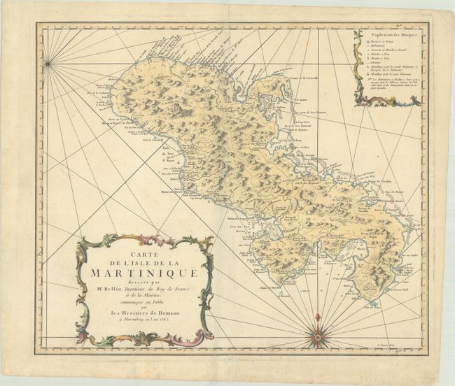
"Carte de l'Isle de la Martinique Dressee par Mr. Bellin, Ingenieur du Roy de France et de la Marine...", Bellin/Homann Heirs
Subject: Martinique

Period: 1762 (dated)

Publication:

Color: Hand Color

Size:
21.6 x 18.3 inches
54.9 x 46.5 cm
Download High Resolution Image
(or just click on image to launch the Zoom viewer)

This is the very handsome German edition of Bellin's large-scale chart of the island. Its meticulous topographical and nautical detail shows roads, topography, soundings, anchorages, villages, windmills, plantations, and more, made clear by the key at top right. Rhumb lines, a compass rose, and two delicate cartouches complete the composition.

References:

Condition: B+

A nice impression on a sheet with a Wolfeg watermark, a soft vertical misfold, and minor foxing. There are archival repairs on verso for edge tears, including a short centerfold separation at top and a tear that enters 2" into map image at bottom.

Estimate: $275 - $350

Sold for: $200

Closed on 6/19/2024

Archived