Catalog Archive
Auction 198, Lot 350

"A Mapp of Cambridgshire: with the Iles of Ely", Blome, Richard

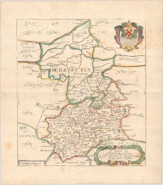
Subject: Eastern England

Period: 1673 (circa)

Publication: Britannia

Color: Hand Color

Size:
10.3 x 11.9 inches
26.2 x 30.2 cm
Download High Resolution Image
(or just click on image to launch the Zoom viewer)

This attractive map of Cambridgeshire was issued in Blome's Britannia: Or, A Geographical Description of the Kingdoms of England, Scotland, and Ireland. Shirley describes the maps in this work as "based on those by John Speed but reduced in size." The northern part of the county is labeled The Ile of Ely, a historic region around the city of Ely that was surrounded by marshland until the Fens were drained starting in 1626. There is fine detail throughout of place names, hundreds, rivers, hills, and more. A dedicatory cartouche at top right honors Sir Thomas Chicheley of Wimpley, Master General of the Ordnance, and is embellished with a coat of arms. At bottom is a distance scale and a decorative title cartouche.

Richard Blome was one of the most interesting, and most active, publishers of illustrated books in post-Restoration London. He is most renowned for what his contemporaries considered the plagiarism of the maps in the Britannia from Camden and Speed. In actuality Blome did not claim that the maps were original works, and the atlas filled an important gap in the market. In the preface he wrote, "I do not own myself the Author, but the Undertaker of this work". He was one of the most active publishers of illustrated books in post-Restoration London and his career provides in insight into the nature and activities of the London map and print trade of the period. There is an excellent biography on MapForum.com.

References: Shirley (BL Atlases) T.BLOM-2a.

Condition: B+

Backed in linen with light scattered foxing, light soiling, and a tiny hole in an unengraved area of the map at top right.

Estimate: $150 - $180

Sold for: $100

Closed on 6/19/2024

Archived