Subject: Southern England
Period: 1607 (circa)
Publication: Camden's Britannia
Color: Hand Color
Size:
12.6 x 11.6 inches
32 x 29.5 cm
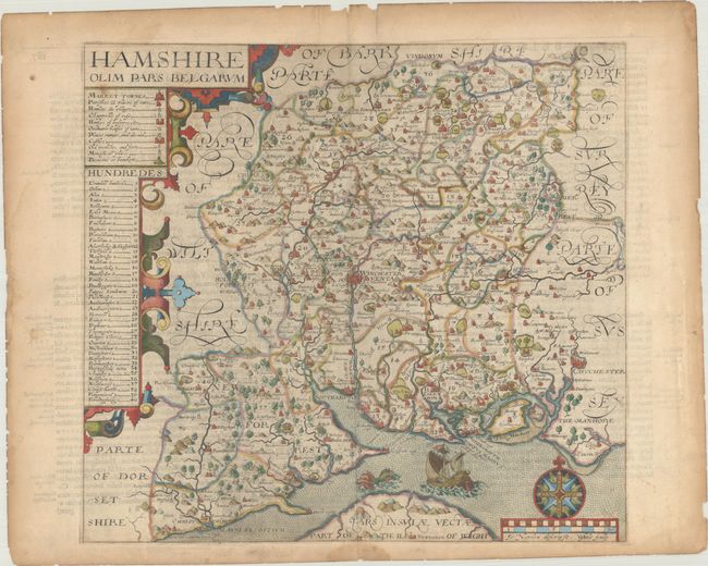
This attractive English county map depicts Hampshire in lovely detail. The county is divided into 40 hundreds, which are helpfully listed in a table at left. A key identifies market towns, parishes, hamlets and villages, Chappells of Ease, Howses of bestereccite and Ordinarie howses of name, ruins, castles, forts, monasteries, and beacons. There are plenty of place names, forests, parks, and rivers as well. The map is sumptuously decorated with strapwork flourishes, a compass rose, a sea monster, and a sailing ship. Engraved by Hole, after John Norden. Published in the 1607 edition of Camden's Britannia, without a plate number on the map. Latin text on verso.
References: Shirley (BL Atlases) T.CAMD-1a.
Condition: B+
On a lightly toned, watermarked sheet with a light spot of foxing under the title, a small dampstain that just touches the neatline at bottom, and tiny chips and tears along the sheet's edges, well away from map image.