Subject: Low Countries
Period: 1730 (circa)
Publication:
Color: Hand Color
Size:
22.7 x 19.4 inches
57.7 x 49.3 cm
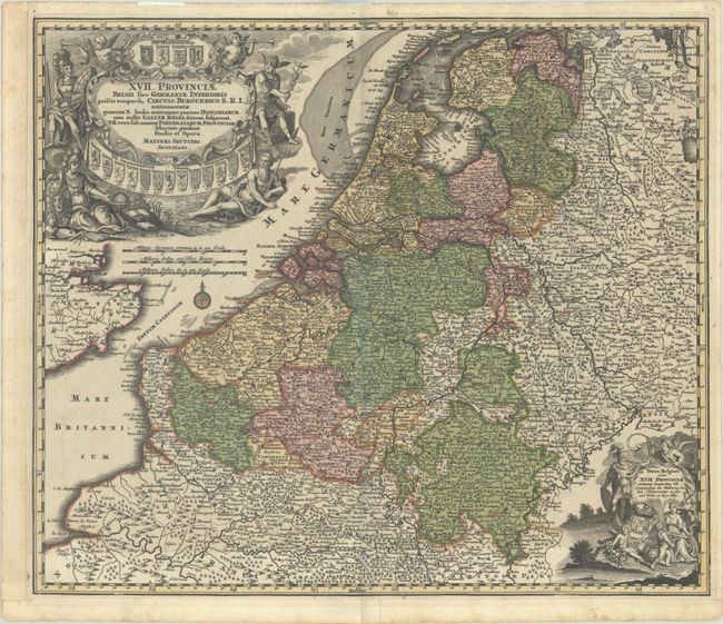
This decorative and highly detailed German map of the Low Countries extends south to Normandy and east into Germany as far as Lippe. The Seventeen Provinces are delineated, and there are plenty of place names and topographical features. The top left corner of the map is dominated by a stunning title cartouche featuring several allegorical figures and the coat of arms of each province. A smaller cartouche at bottom right includes a secondary title, Totum Belgium sive XVII. Provinciae..., and allegorical figures symbolizing the region's abundance and might.
References:
Condition: B+
A sharp impression with full contemporary color on a sheet with margins that have been extended with old paper at left and bottom. There are some small wormholes along the centerfold, minor soiling, and old manuscript notations in red ink. Small remnants of hinge tape on recto and verso.


