Subject: France
Period: 1635 (published)
Publication: Toonneel des Aerdrycks
Color: Hand Color
Size:
19.6 x 14.9 inches
49.8 x 37.8 cm
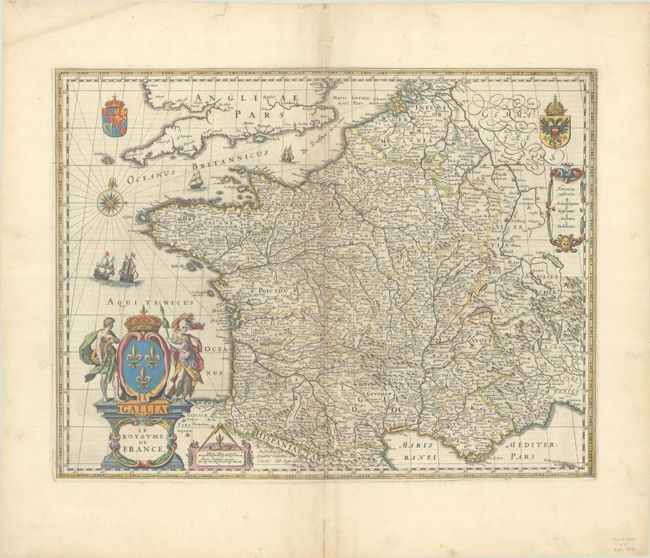
This elaborately engraved map of France is divided into provinces. Numerous towns and cities are located, and there is good topographical detail. A compass rose capped with a fleur-de-lis and four sailing ships appear in the English Channel and Atlantic. Two coats-of-arms, representing the king and the House of Habsburg, are shown in the top corners. There are three cartouches: an ornate title cartouche with a crown and allegorical figures, a distance scale cartouche with measuring dividers on top, and another containing a key identifying episcopal and archepiscopal seats, universities, and parliamentary seats. As the bottom of the title cartouche indicates, this was engraved by Josua van den Ende, who had a fruitful working relationship with Blaeu. Dutch text on verso.
References: Van der Krogt (Vol. II) #4000:2A.3.
Condition: A
A nice impression with full contemporary color on a bright sheet with marginal soiling and an extraneous crease at bottom left. There are archival repairs to a centerfold separation in the bottom margin and a short tear in the top margin.