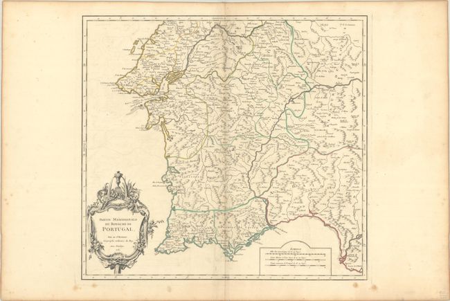
Subject: Southern Portugal
Period: 1751 (dated)
Publication: Atlas Universel
Color: Hand Color
Size:
20.3 x 19 inches
51.6 x 48.3 cm
This large and finely detailed chart covers the southern part of Portugal from about Torres Vedras southward. Locates the fortified city of Lisbone with scores of other place names. The map is filled with much topographical detail of mountains, rivers and political divisions and ornamented with a large title cartouche engraved in the French style.
References: Pedley #321.
Condition: B+
A dark impression with contemporary outline color on a wide-margined sheet with the watermarks of a small birdhouse and "B. Richard Fin 1749." There is light offsetting, minor toning along the centerfold and edges of the sheet, and a few spots of foxing in the blank margins.