Catalog Archive
Auction 198, Lot 452

"Germaniae Vulgo Duitschland Tabula Comprehendens Accuratam...", Elwe, Jan Barend

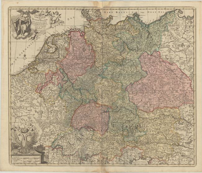
Subject: Central Europe, Germany

Period: 1792 (dated)

Publication:

Color: Hand Color

Size:
22.9 x 19.5 inches
58.2 x 49.5 cm
Download High Resolution Image
(or just click on image to launch the Zoom viewer)

A detailed map of the German Empire stretching from the Netherlands to Poland with Switzerland and northern Italy in the southern portion of the map. The title is displayed on a banner supported by putti and an eagle, with a king shown to the left. The scale of miles is topped with the double-headed eagle of the German Empire crowned by two putti.

References:

Condition: B+

A crisp impression with full contemporary color on watermarked paper. There is some staining at the top and bottom of the centerfold and a small repaired chip in the top blank margin that just touches the border.

Estimate: $160 - $190

Sold for: $120

Closed on 6/19/2024

Archived