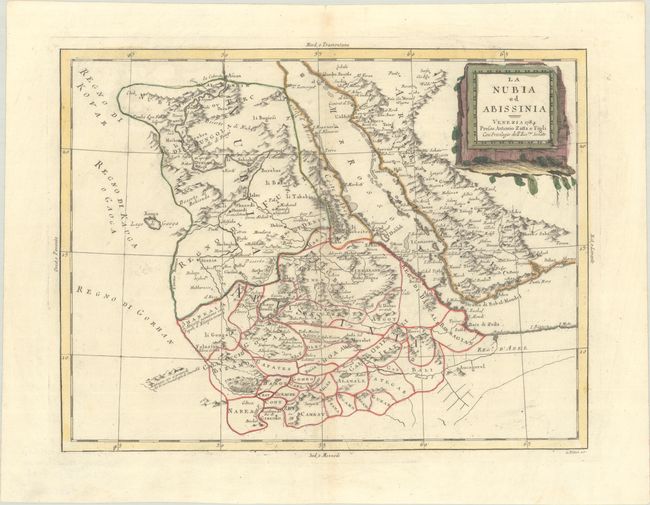
Subject: Eastern Africa
Period: 1784 (dated)
Publication: Atlante Novissimo
Color: Hand Color
Size:
15.9 x 12.1 inches
40.4 x 30.7 cm
This delicately engraved sheet covers the historical regions of Nubia and Abissinia, covering parts of present-day Egypt, Sudan, Eritrea, Djibouti, and Ethiopia. It spans from Aswan south to the throne of the Kingdom of Gingiro, and also includes the southwestern part of the Arabian peninsula from Mecca to Aden. The title cartouche appears on a stone monolith. Engraved by G. Pitteri.
References: Shirley (BL Atlases) T.ZAT-1a, Vol. 4 #20.
Condition: A
Contemporary color on a sheet with the watermark of three crescent moons typically found on Zatta maps. Along the centerfold there is faint toning and a couple tiny separations.


