Catalog Archive
Auction 198, Lot 655

"Carte de l Egypte de la Nubie de l'Abissinie &c.", Delisle/Elwe

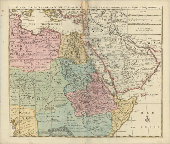
Subject: Eastern Africa

Period: 1792 (dated)

Publication:

Color: Hand Color

Size:
22.3 x 19.2 inches
56.6 x 48.8 cm
Download High Resolution Image
(or just click on image to launch the Zoom viewer)

This detailed map of northeastern Africa, the Red Sea and the Arabian peninsula shows the political divisions and kingdoms, roads, topography, settlements, encampments and much more. The Nile originates in the mountains near the L. de Dambee. The map is filled with notations concerning the various tribes, trade routes, and the location of emeralds.

References: cf. Norwich #298.

Condition: B

A crisp impression with full contemporary color on watermarked paper. There is some staining along the upper centerfold and a repaired chip at top with some small loss of map title.

Estimate: $160 - $190

Unsold

Closed on 6/19/2024

Archived