Subject: North America, Texas
Period: 1844 (circa)
Publication: National Atlas of Historical, Commercial and Political Geography
Color: Hand Color
Size:
19.7 x 24.1 inches
50 x 61.2 cm
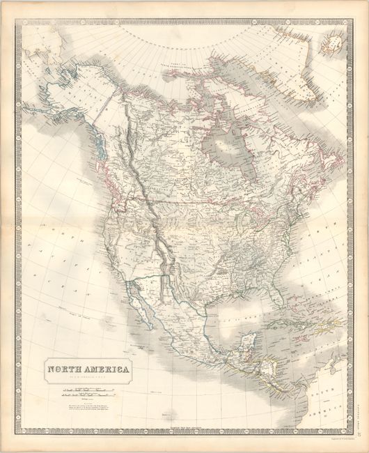
This interesting map of North America shows much of the West in transition. Upper or New California takes up most of the Southwest of the United States, with a narrow finger of Mexico squeezed in between California and the independent Republic of Texas (which is not colored separately in this example, but the positioning of "United States" makes it clear that Texas is still a Republic). Above California is Oregon Territory which shows the boundary with British America along the Columbia River, reflecting British claims in the region. There is good detail for a map of this scale, particularly of the river systems.
References:
Condition: A
Contemporary outline color on a sturdy sheet. There are a few faint spots in the image and some minor toning and soiling in the blank margins.