Subject: United States & Canada
Period: 1946 (dated)
Publication:
Color: Printed Color
Size:
26.1 x 26.2 inches
66.3 x 66.5 cm
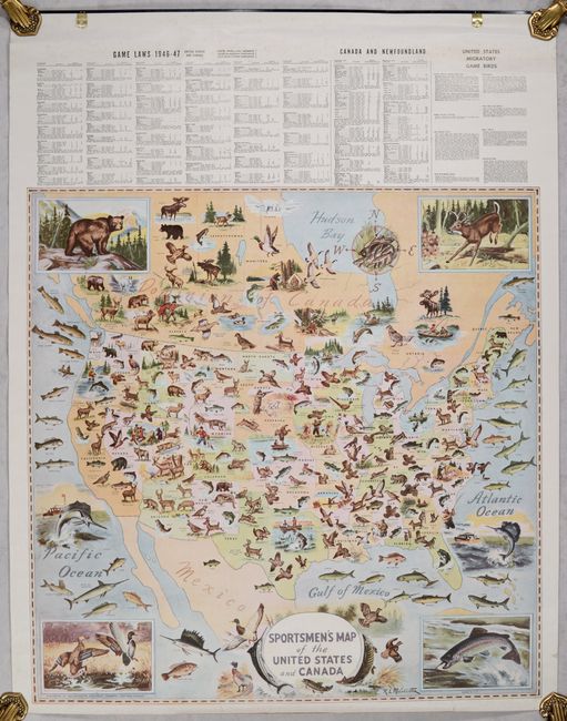
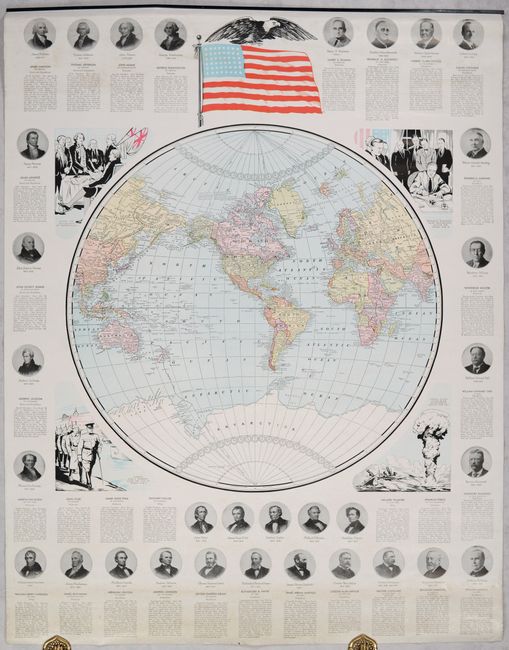
This colorful map, illustrated by R.L. McCollister, is filled with sporting animals and conveys a significant amount of information related to the hunting and fishing opportunities across the United States and Canada. Above the map are gaming laws for both countries for the 1946-47 season. In addition to the Sportsmen's map, there are large maps showing the United States, Europe, Asia, and a world map surrounded by presidential portraits. Maps are on both sides of two sheets (27.8 x 35.5"), which are held together by a small metal fastener at top. An unusual and apparently rare wall map set that was especially ephemeral because the game laws applied to only one season. We found no past sales records or institutional examples for this 1946 edition, and only 1 sales record (1954, OWA) and 1 OCLC record (1956) for any edition.
References:
Condition: A
Maps are clean and bright. There is a bit of foxing along the top margin of the first map and some minor wear and tiny edge tears confined to the margins.