Catalog Archive
Auction 199, Lot 416

"Royaume de Danemarck, qui Comprend le Nort-Jutland Divise en ses Quatre Dioceses, le Sud-Jutland Divise en ses Deux Duches de Sleswick et de Holstein, et les Isles de Fionie, Selande, Laland, &c.", Robert de Vaugondy, Gilles

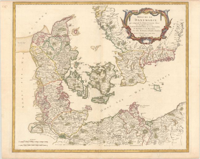
Subject: Denmark & Southern Sweden

Period: 1750 (dated)

Publication: Atlas Universal

Color: Hand Color

Size:
22.5 x 19.3 inches
57.2 x 49 cm
Download High Resolution Image
(or just click on image to launch the Zoom viewer)

This lovely map of Denmark extends to include Schleswig-Holstein, the Pomeranian coast, and southern Sweden. There is good detail of rivers, mountains, lowlands, forests, cities, and towns. A large decorative title cartouche fills the top right corner. This is the second state, published after 1768, with lettering changes and spelling changes for certain place names (Malmuye is now Malmo, for instance).

References: Pedley #72.

Condition: B+

Contemporary outline color in the map with later color in the cartouche, on a sheet with the watermark of the Society of Jesus (IHS). There are a few faint spots, a hint of toning along the centerfold, and an archival repair to a tiny horizontal tear near center.

Estimate: $160 - $190

Sold for: $100

Closed on 9/11/2024

Archived