Catalog Archive
Auction 199, Lot 422

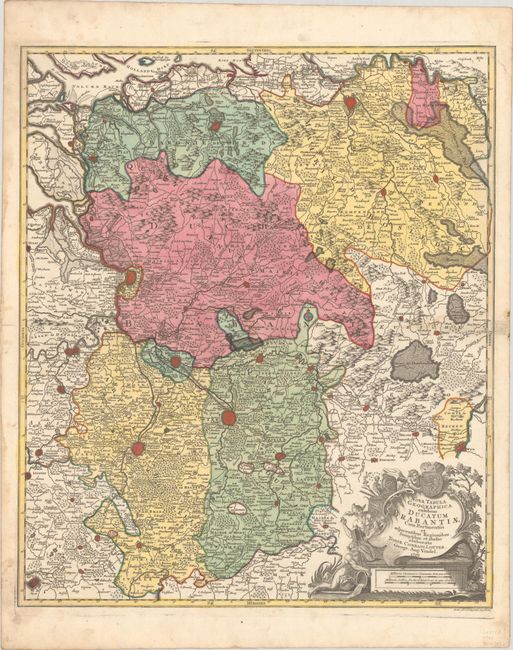
"Nova Tabula Geographica Exhibens Ducatum Brabantiae cum Pertinentiis et Adjacentibus Regionibus", Lotter, Tobias Conrad
Subject: Central Belgium

Period: 1761 (dated)

Publication:

Color: Hand Color

Size:
19.3 x 22.8 inches
49 x 57.9 cm
Download High Resolution Image
(or just click on image to launch the Zoom viewer)

This decorative map is centered approximately on Aarschot and extends from Mons, to Maastricht, to Breda, to Dendermonde. Large cities are depicted as miniature bird's eye plans, including the aforementioned cities, as well as Brussels and Antwerp. There is incredible detail of hundreds of tiny towns, roads, political boundaries, forests, marshes, rivers, and mountains. The map is adorned with a decorative title cartouche featuring Mercury, a river god, and the arms for the Duchy of Brabant.

References:

Condition: B+

A sharp impression with full contemporary color on a bright, watermarked sheet with a faint dampstain along the centerfold at far right and marginal soiling.

Estimate: $200 - $230

Unsold

Closed on 9/11/2024

Archived