Subject: Caspian Sea
Period: 1721 (circa)
Publication: Histoire de l'Académie Royale des Sciences
Color: Hand Color
Size:
9.3 x 17.6 inches
23.6 x 44.7 cm
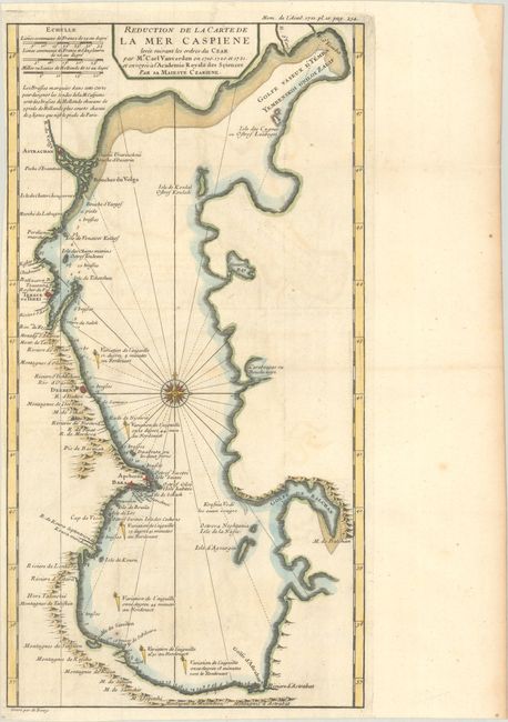
This uncommon map of the Caspian Sea was based on the surveys of Karl van Verden from 1719-21. The Caspian Sea remained a mystery through much of cartographic history. It was originally thought to be a huge gulf in the northern ocean and was not recognized as a landlocked sea until the late medieval period. It was then presented in a variety of shapes and sizes, nearly always on an east-west axis. It was not accurately mapped until the early 18th century when the surveys of Karl van Verden were commissioned by Russia. In 1721, Peter the Great presented the French Academy a copy of the recently completed map by S.I. Soimonov and Karl van Verden. This map was engraved by Charles Berey for Histoire de l'Académie Royale des Sciences and shows the updated outline of the Caspian Sea with numerous place names and depth soundings along the coastline.
References:
Condition: B+
A dark impression, issued folding on a watermarked sheet with light offsetting and a narrow left margin. There is a light dampstain along the right edge of the sheet, well away from the image.