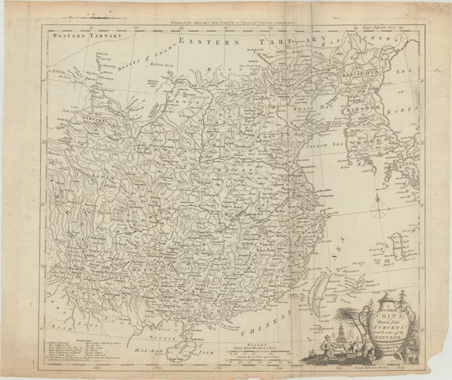
Subject: China & Korea
Period: 1782 (circa)
Publication: Millar's New and Universal System and Geography
Color: Black & White
Size:
15.1 x 13.4 inches
38.4 x 34 cm
This later Kitchin map of China and its surroundings stretches from Tibet to the Sea of Japan, here called the Sea of Korea. China is dense with detail, with mountains, provinces, rivers, and many cities noted. Tay-wan or Formosa I., Nan-King, Canton, and the Gulf of Tonkin appear. There are two distance scales, a compass rose topped with a fleur-de-lis, a decorative title cartouche featuring figures in local dress near a massive vase, and a key at bottom left that translates regional geographic terms into English.
References: McCorkle (18th C. Geography Books) #281-4.
Condition: B
Issued folding with extraneous creasing around the fold at right, light toning at top and bottom, a few short edge tears that have been closed with archival tape on verso, and a chip in the bottom right blank margin.


