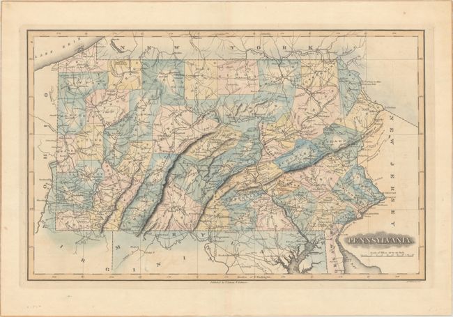
Subject: Pennsylvania
Period: 1823 (circa)
Publication: A General Atlas
Color: Hand Color
Size:
18 x 11.4 inches
45.7 x 29 cm
This uncommon and detailed map of Pennsylvania is dense with place names and topographical detail. It delineates the state's early network of wagon roads, including a "State Road from Kittaning to Hamilon." County configuration is current to the date of the map. Lucas' General Atlas is known as one of the finest general atlases produced in the U.S. at the time, due to the high quality paper, superior engraving quality, and attractive coloring style. Engraved by B.T. Welch & Co. in Baltimore.
References: Phillips (Atlases) #742-58.
Condition: B+
Contemporary color with faint offsetting. There are short archivally repaired centerfold separations confined to the top and bottom blank margin.