Subject: Eastern Mediterranean & Middle East
Period: 1792 (dated)
Publication: Atlas Geographique et Universel
Color: Hand Color
Size:
24.3 x 17.9 inches
61.7 x 45.5 cm
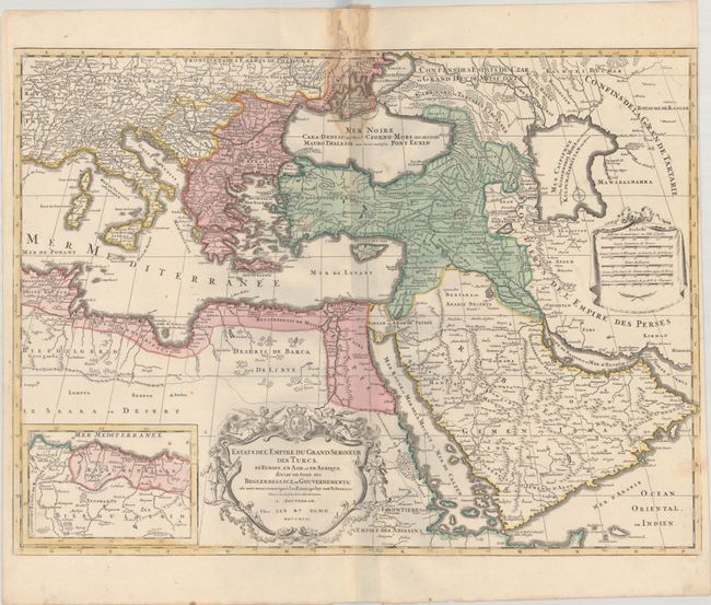
A large, decorative map of the Turkish Empire, covering territories in the Balkans, Anatolia, Levant, North Africa and Arabia. The map includes an inset of the eastern-most provinces in North Africa. It is embellished with a drape-style distance scale cartouche and a large title cartouche decorated by angels, soldiers and the royal French arms.
The copperplate for this map was originally created by Reiner and Joshua Ottens, who sold the plate to Elwe. The Ottens had copied the map from Alexis-Hubert Jaillot's map of the region. After acquiring the plate, Elwe erased the Ottens' imprint and added his own. The Elwe issue is very uncommon.
References: Shirley (BL Atlases) T.ELW-2a.
Condition: B
A sharp impression with full contemporary color on a bright sheet with two small elephant watermarks and a few small spots in the image at left. There is dampstaining along the centerfold at top, resulting in small tears and abrasions in the border and a chip in the blank margin that has been archivally repaired.