Showing Featured Lots(remove filter)
Filtered by Category:United States(Show All Categories)
Showing results for:Auction 188
Catalog Archive
14 lots
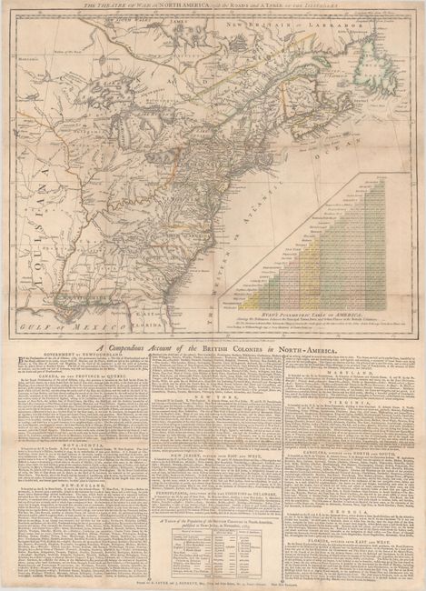
Auction 188, Lot 106
Subject: Colonial Eastern United States & Canada
Sayer & Bennett
The Theatre of War in North America, with the Roads and a Table of the Distances, 1776
Size: 20.1 x 16.1 inches (51.1 x 40.9 cm)
Estimate: $10,000 - $13,000
Early Broadside Informing British Readers of the Brewing War - First State
Unsold
Closed on 6/22/2022
Auction 188, Lot 110
Subject: Colonial Northeastern United States & Canada
Delisle/Covens & Mortier
Carte du Canada ou de la Nouvelle France et des Decouvertes qui y ont ete Faites..., 1730
Size: 22.6 x 19.3 inches (57.4 x 49 cm)
Estimate: $1,200 - $1,500
One of the Most Influential Maps of Canada, Great Lakes & Upper Midwest
Sold for: $850
Closed on 6/22/2022
Auction 188, Lot 131
Subject: Colonial Eastern United States
Delisle, Guillaume
Carte de la Louisiane et du Cours du Mississipi Dressee sur un Grand Nombre de Memoires Entrautres sur ceux de Mr. le Maire, 1718
Size: 25.2 x 19.1 inches (64 x 48.5 cm)
Estimate: $5,500 - $7,000
A Foundation Map for the Mississippi Valley and the First Appearance of Texas on a Printed Map
Sold for: $3,500
Closed on 6/22/2022
Auction 188, Lot 132
Subject: Colonial Eastern United States
Bellin, Jacques Nicolas
Carte de la Louisiane et des Pays Voisins Dediee a M. Rouille Secretaire d'Etat, Ayant le Departement de la Marine, 1750
Size: 23.9 x 18.6 inches (60.7 x 47.2 cm)
Estimate: $1,600 - $1,900
Bellin's Scarce French and Indian War-Era Map of the Colonial United States - First State
Sold for: $1,000
Closed on 6/22/2022
Auction 188, Lot 140
Subject: Eastern United States, Franklin
Neele, Samuel John
United States, 1813
Size: 11.3 x 8.9 inches (28.7 x 22.6 cm)
Estimate: $1,000 - $1,300
Map Depicting Proposed State of "Franklinia" and Other Short-Lived Territories
Sold for: $1,000
Closed on 6/22/2022
Auction 188, Lot 141
Subject: Eastern United States
Melish, John
United States of America Compiled from the Latest & Best Authorities, 1818
Size: 19.6 x 16.1 inches (49.8 x 40.9 cm)
Estimate: $1,800 - $2,200
Early & Separately Issued Version of Melish's Important Map
Sold for: $2,200
Closed on 6/22/2022
Auction 188, Lot 145
Subject: Colonial New England & Mid-Atlantic United States
Jansson/Valck & Schenk
Nova Belgica et Anglia Nova, 1694
Size: 19.5 x 15.1 inches (49.5 x 38.4 cm)
Estimate: $1,900 - $2,200
Jansson's Influential Map of the East Coast - Valck & Schenk Edition
Unsold
Closed on 6/22/2022
Auction 188, Lot 150
Subject: Colonial Mid-Atlantic United States
Merian, Matthaus
Virginia - Erforshet und Beschriben durch Capitain Iohan Schmidt, 1627
Size: 14.2 x 11.6 inches (36.1 x 29.5 cm)
Estimate: $5,000 - $6,000
The Third Derivative of Capt. John Smith's Foundation Map of Virginia
Sold for: $4,000
Closed on 6/22/2022
Auction 188, Lot 151
Subject: Colonial Mid-Atlantic United States
Hondius, Henricus
Nova Virginiae Tabula, 1638-58
Size: 19.4 x 15.1 inches (49.3 x 38.4 cm)
Estimate: $1,800 - $2,200
One of the Most Important 17th Century Maps of the Chesapeake Bay
Sold for: $1,200
Closed on 6/22/2022
Auction 188, Lot 154
Subject: Colonial Mid-Atlantic United States
Aa, Pieter van der
Virginie, Grande Region de l'Amerique Septentrionale, avec Tous ses Bourgs, Hameaux, Rivieres et Bayes, Suivant les Recherches Exactes de ceux qui l'ont Decouverte…, 1729
Size: 14 x 11.4 inches (35.6 x 29 cm)
Estimate: $1,600 - $1,900
Rare Derivative of John Smith's Map of the Chesapeake Bay
Sold for: $1,200
Closed on 6/22/2022
Auction 188, Lot 156
Subject: Mid-Atlantic United States
Robert de Vaugondy, Didier
Carte de la Virginie et du Maryland Dressee sur la Grande Carte Angloise de Mrs. Josue Fry et Pierre Jefferson, 1793
Size: 25.4 x 19.1 inches (64.5 x 48.5 cm)
Estimate: $1,600 - $1,900
An Essential Map of Virginia and Maryland
Sold for: $1,000
Closed on 6/22/2022
Auction 188, Lot 192
Subject: Northern California
[Map of the Bay Area] [in] Automobile and Motorcycle Road Book California, 1907
Size: 12.5 x 15.4 inches (31.8 x 39.1 cm)
Estimate: $300 - $500
First California Motorist’s Atlas
Sold for: $1,300
Closed on 6/22/2022
Auction 188, Lot 249
Subject: Virginia, Civil War
West & Johnston
Map of the State of Virginia Containing the Counties, Principal Towns, Railroads Rivers, Canals & All Other Internal Improvements, 1862
Size: 37.4 x 25.6 inches (95 x 65 cm)
Estimate: $7,500 - $9,000
Rare Civil War Map Based on Bucholtz Map of Virginia
Sold for: $4,950
Closed on 6/22/2022
Auction 188, Lot 255
Subject: Southwestern United States & Mexico, California
Fer, Nicolas de
Cette Carte de Californie et du Nouveau Mexique, est Tiree de Celle qui a ete Envoyee par un Grand d'Espagne pour Etre Communiquee a Mrs. de l'Academie Royale des Sciences, 1705
Size: 13.4 x 8.9 inches (34 x 22.6 cm)
Estimate: $1,200 - $1,500
De Fer's Important Map of the Island of California
Sold for: $900
Closed on 6/22/2022
14 lots


