Catalog Archive
Auction 131, Lot 667
"Tractus Borysthenis vulgo Dniepr et Niepr dicti, a Kiovia ad Urbum Oczakow ubi in Pontum Euxinum se exonerat", Jansson/Pitt
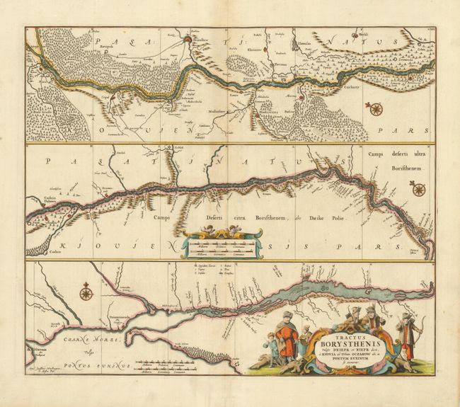
Subject: Eastern Europe, Dnieper River
Period: 1680 (circa)
Publication:
Color: Hand Color
Size:
21.3 x 18.2 inches
54.1 x 46.2 cm
Download High Resolution Image
(or just click on image to launch the Zoom viewer)
(or just click on image to launch the Zoom viewer)