Subject: Czech Republic
Period: 1720 (dated)
Publication:
Color: Hand Color
Size:
106 x 91 inches
269.2 x 231.1 cm
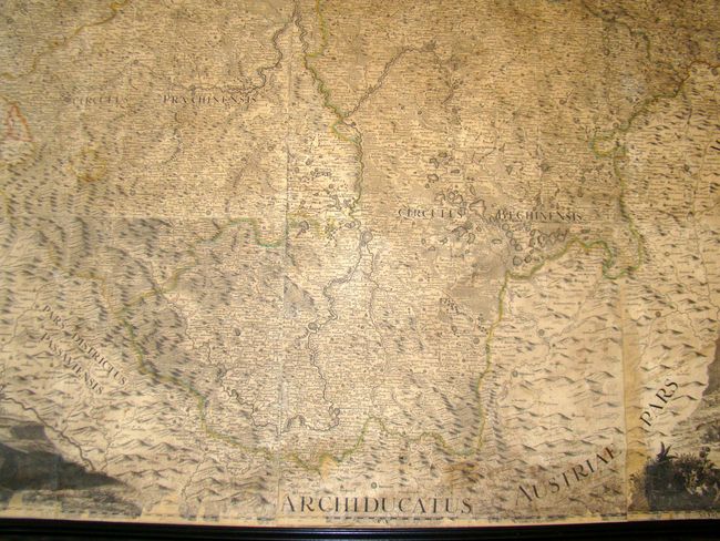
This massive wall map, by Johann Christopher Muller, is comprised of 25 sheets joined together to form an impressive, highly detailed map of the Czech Republic. Muller, born in 1673 near Nurnberg, studied mathematics and engineering drawing. He was asked by Emperor Carl VI to create a complete map of the Czech Kingdom. Muller proceeded to map the 12 Czech provinces and the districts of Cheb and Glatz using a viatorius (measuring wheel) behind a chariot to measure distances, a compass, and an astronomical quadrant. W.L. Reinner designed the cartouche, M. Kauffer engraved the map, and J.D. Hertz engraved the decorations and explanations. The map depicts towns of various sizes, rivers, main roads, and topography, with over 12,000 place names. This monumental work became the standard for maps of Bohemia for the following 100 years.
The title cartouche shows the bounty of the land with putti holding grapes, hunters on horseback pursuing stags and other wild game, and Demeter, the goddess of harvest. The legend at bottom left is surrounded by miners and stone carvers. The top-left corner shows angels holding a drape that features a view of the Charles bridge crossing the Vltava River in Prague. The vignette at top-right corner, bordering the region of Silesia, features the coat of arms of Bohemia held by putti and the black eagle of Silesia, while river gods and goddesses pour vessels of water to symbolize the rivers of the region.
Extra shipping charges will apply due to the size and weight. Please call for a quote.
References:
Condition: B+
Original outline color and expertly restored. Backed on linen with new rollers. Some areas of loss reproduced in facsimile, including about 4" on entire left-hand side, and small areas in four corners and along border. At top there is some cracking towards the center, with a 1" square piece missing. A few areas have gridlines of longitude and latitude drawn in old ink. Overall an impressive piece in very good condition for a map of this size.


