Subject: North Atlantic, Cuba, Spanish-American War
Period: 1898 (circa)
Publication: La Depeche
Color: Printed Color
Size:
28.3 x 20.4 inches
71.9 x 51.8 cm
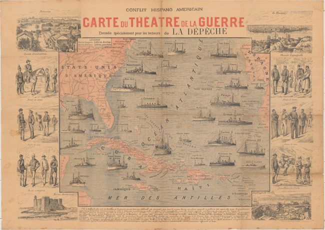
This interesting piece of ephemera was issued as a supplement to La Depeche newspaper, based out of Toulouse in southwestern France near the Spanish border. The map depicts the naval fleets of both Spain and the United States in the North Atlantic Ocean, and is representative of the 10 week-long Spanish-American War which was primarily fought over Cuban independence. The map is surrounded by vignettes depicting the costumes of both American and Spanish military forces as well as views of Havana, Santiago de Cuba and Matanzas. The Americans won the short battle which gave them temporary control of Cuba and possession of Puerto Rico, Guam and the Philippines, thus eliminating Spain's final possessions in the Americas and Asia. Engraved by Charaire.
References:
Condition: B
Issued folding with light toning, scattered foxing and staining, and a few short edge tears well away from the map image.


