Subject: References
Period: 1969-72 (published)
Publication:
Color:
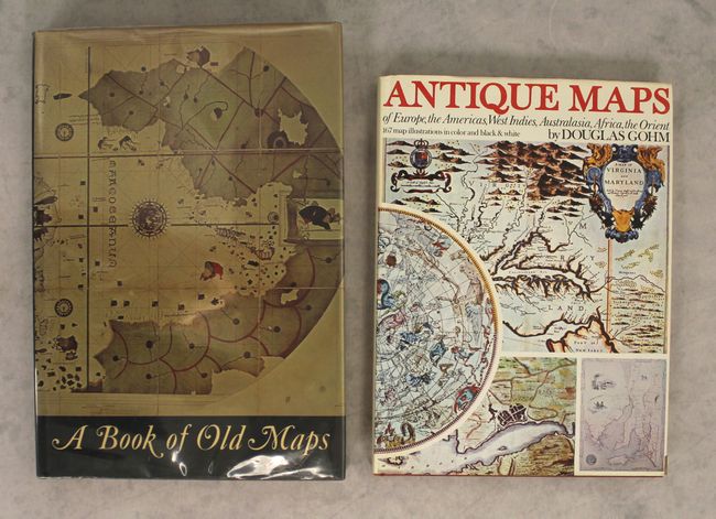
A. A Book of Old Maps Delineating American History from the Earliest Days Down to the Close of the Revolutionary War, by Emerson D. Fite and Archibald Freeman, published 1969, black & white (10.1 x 14.5"). An excellent study of American cartographic developments in 74 selected maps made between 1474 and 1825. These maps provide a unique view of an important stage in the growth of America. Each map has an accompanying essay describing its background and historical importance. Illustrated in black and white, 299 pages, hardbound with gilt title on spine and an illustrated dust jacket protected by Mylar. Compiled and edited by Emerson D. Fite & Archibald Freeman, Arno Press, New York, 1969. Reprint of the Harvard University Press edition of 1926. Condition: Contents very good with minor toning along the edges of the pages. Covers very good with minor soiling and shelf wear. There is light wear and a couple small damp stains on the dust jacket. (A)
B. Antique Maps of Europe, the Americas, West Indies, Australasia, Africa, the Orient, by Douglas Gohm, published 1972, printed color (9.6 x 12.9"). This fine overview of antique maps features brief biographies of major cartographers. It covers a very wide selections of maps from the 15th to the 19th centuries. 128 pp., nearly 170 illustrations, 65 in full color. Hardbound in rust cloth with gold title and decoration on cover and an illustrated dust jacket. Condition: Contents good with light scattered foxing on some of the pages. Covers very good with minor shelf wear. The dust jacket has light shelf wear, minor soiling, and a couple short tears. (B+)
References:
Condition:
See description above.


