Catalog Archive
Auction 161, Lot 478
NO RESERVE
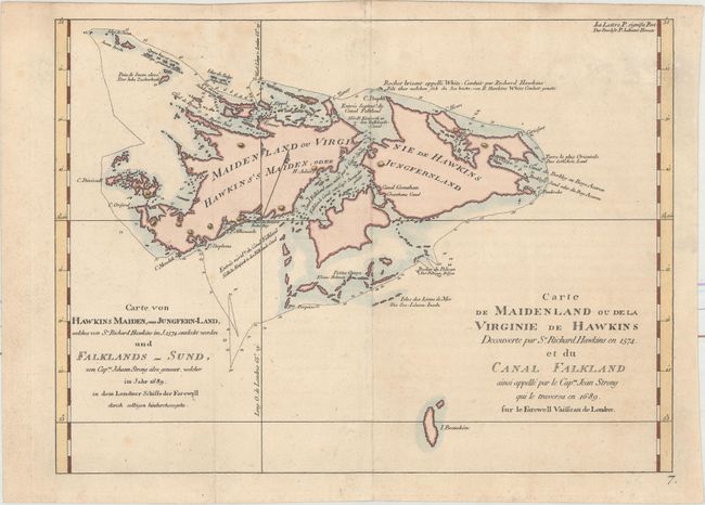
"Carte de Maidenland ou de la Virginie de Hawkins Decouverte par Sr. Richard Hawkins en 1574. et du Canal Falkland... / Carte von Hawkins Maiden, oder Jungfern-Land, Welches von Sr. Richard Hawkins im J. 1574. entdeckt Worden un Falklands-Sund..."

Subject: Falkland Islands
Period: 1774 (published)
Publication: Cartes et Figures des Voyages...
Color: Hand Color
Size:
11.6 x 8.6 inches
29.5 x 21.8 cm
Download High Resolution Image
(or just click on image to launch the Zoom viewer)
(or just click on image to launch the Zoom viewer)

