Subject: Western Sicily, Italy
Period: 1826 (dated)
Publication: Neptune de la Mediterranee
Color: Black & White
Size:
24.4 x 18.3 inches
62 x 46.5 cm
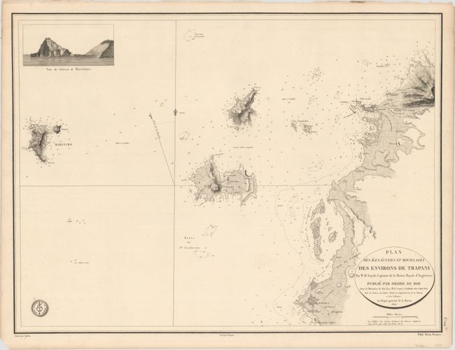
This scarce chart focuses on the stretch of Sicilian coastline from Trapani to Marsala. The fortifications of both cities are shown, and a number of salt works are located. There is fine topographical detail along the coasts, and the water is filled with navigational information such as soundings, hazards, and bottom types. Nearby islands Levanzo, Favignana, and Marettimo are identified and rendered in intricate detail. An inset view at top left depicts the Casa Romana that overlooks the sea on the Marettimo coast. Drawn by Besancon and engraved by Caplin. Published by the Depot de la Marine, with the engraved seal at bottom left and the price at bottom right: Prix Deux Francs.
References:
Condition: A
A fine impression on a sheet with a Depot de la Marine watermark. There are two small holes in an unengraved area at right and a couple of unobtrusive spots of foxing. Minor toning is confined to the margins, as is a short edge tear at right.


