Subject: South America
Period: 1788-97 (circa)
Publication:
Color: Black & White
A. An Accurate Map of South America, from the Best Modern Maps and Charts, by Thomas Bowen, from A New and Authentic System of Universal Geography, circa 1788 (18.1 x 12.8"). This delicately engraved map of the continent features simple interior topography. It is full of place names and locates many native tribes. The interior is mostly blank with some notes of waterfalls and rivers in the Amazon basin. Coastal areas are well detailed, and the Galapagos Islands are noted and named, as well as a phantom island near the southern tip named Peppy's I. Imaginary. Condition: Issued folding with a few light spots and faint offsetting. There are some short fold separations in the blank margins and light toning along the sheet's edges, well away from map image. (B+)
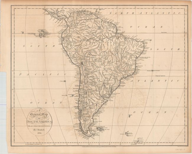
B. A General Map of South America Drawn from the Best Surveys, by John Russell, dated 1794 (18.0 x 14.3"). This detailed map shows South America and the lower portion of Central America. Mountains, rivers, lakes, towns, and a few roads are located. The mythical Lake Parime appears in Guiana, and a large area in the center of the map is labeled Amazonia. The southern part of present-day Argentina is named Patagonia. At left, along the Equator are the Galapagos Islands. This is one of nine maps engraved by John Russell of London and published in John Reid's An American Atlas. The same nine maps were included in An Historical, Geographical, Commercial and Philosophical View of the American United States by William Winterbotham (1763-1829), published in London in 1795 and 1799 and in New York in 1796 (some maps by other engravers). Reid's An American Atlas was meant to accompany the version of Winterbotham's history published without the maps. Condition: Issued folding with light offsetting, a binding tear that just enters the neatline at left, and toning that is most pronounced along the sheet's edges. (B)
C. A Map of South America and the Adjacent Islands, by (Rev.) Jedidiah Morse, from The American Gazetteer..., dated 1797 (5.0 x 6.6"). This miniature map of South America includes a large region in the center is labeled Amazonia. The Galapagos Islands, discovered in 1535, are shown off the coast of Ecuador while the Cape Verde Islands are shown outside the right neatline. The tracks of Captain Cook in 1768 and Captain Wallis in 1767 are also traced. Engraved by Benjamin Callender and published in Jedidiah Morse's The American Gazetteer (1761- 1826). Reference: Wheat & Brun #714. Condition: A nice impression with binding holes in the left blank margin that have been closed on verso. (A)
References:
Condition:
See description above.


