Subject: New South Wales, Australia
Period: 1926 (circa)
Publication:
Color: Black & White
Size:
5.5 x 8.8 inches
14 x 22.4 cm
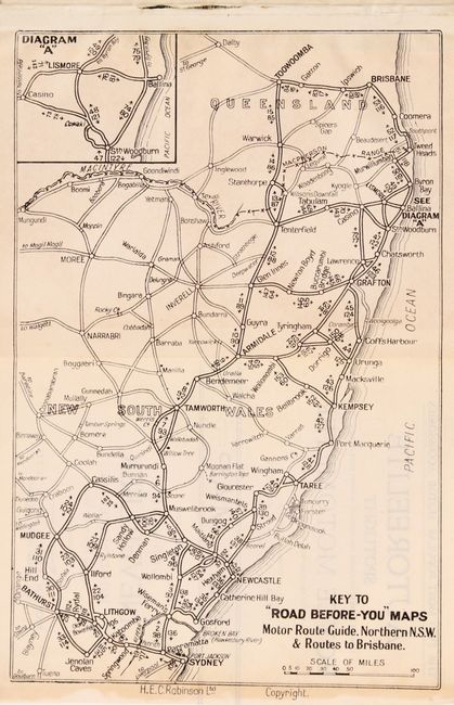
This road guide focuses on the northeastern part of New South Wales from Sydney to Brisbane. With the exception of the larger key map, the maps are presented in strip-map style, which are called "road-before-you" maps on the title page. There are 154 strip maps each with a detailed description of the route, plus the folding key map and a number of advertisements scattered throughout. The maps were drawn by H. E. C. Robinson. Compiled by the N.S.W. Government Tourist Bureau and the National Roads & Motorists' Association of New South Wales. Published by the Australian Guide Book Co. Hardbound with pictorial covers.
References:
Condition: B+
Light soiling throughout. Covers are moderately soiled.