Subject: United States & Canada, Flight Maps
Period: 1950-60 (circa)
Publication:
Color: Printed Color
This lot includes three souvenir route maps from Canadian-based airlines.
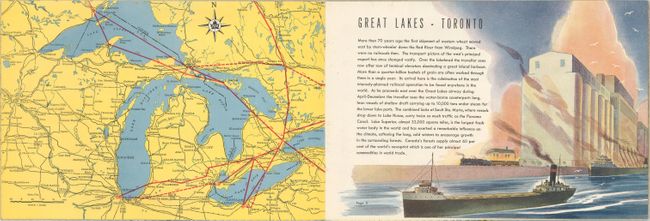
A. TCA Air Route Maps, by Trans-Canada Air Lines, circa 1950 (10.0 x 6.8"). This booklet includes detailed route maps between Canada, the United States, the Caribbean, and Britain. Each map is accompanied by a lovely vignette and description of the region.
B. Trans-Canada Air Lines Air Canada, by Trans-Canada Air Lines, circa 1960 (8.0 x 9.0"). This tri-lingual booklet includes 7 regional route maps with descriptions of each region, and a large center-fold of the full route map between North America, Europe, and the Caribbean.
C. Route Map Vancouver to Amsterdam, by Canadian Pacific Airlines, circa 1955 (29.9 x 8.4"). This route map extends from Vancouver, Canada to Sondrestrom, Greenland, to Amsterdam, Netherlands.
References:
Condition: A
Very minor wear.


