Subject: South China Sea
Period: 1775 (circa)
Publication: Neptune Oriental
Color: Hand Color
Size:
19 x 26.2 inches
48.3 x 66.5 cm
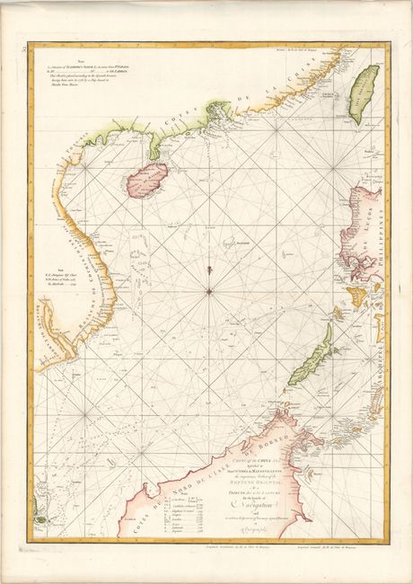
This striking sea chart extends from the southeast coast of China and Taiwan (here Isle Formose) south to the northern portion of Borneo, where Brunei and Malaysia are now located. Part of the Philippines appears at right, including Manila. Hundreds of tiny islands are shown. There is little inland detail, but numerous locations are named along the coasts. Throughout the chart are soundings and the tracks of various voyages between 1752 and 1763, which are identified in a key to the left of the title. A compass rose capped with a fleur-de-lis lies in the center of the map, radiating rhumb lines. Alexander Dalrymple was a Scottish hydrographer who explored the East Indies as an employee of the East India Company.
References:
Condition: A
A nice impression on a bright sheet with a birdhouse watermark and professional repairs to a few small worm tracks around Mindoro.