Subject: Africa
Period: 1669 (dated)
Publication: Cartes Generales de Toutes les Parties du Monde…
Color: Hand Color
Size:
21.8 x 15.8 inches
55.4 x 40.1 cm
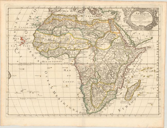
This is the second state of Guillaume Sanson and Pierre Mariette's handsome map of Africa. It is a revised and re-engraved version of the elder Sanson's map of 1650 with more rivers, mountains, forests, and place names. Many of the new place names reflect the increasing French influence on the continent. Madagascar has the additional title Isle Dauphine, with Fort Dauphine located in the southern part of the island. A river off the Cape of Good Hope has been added, as well as several other rivers in the south. The map is filled with spurious details including the twin lake sources of the Nile and peculiar mountain ranges. The format includes the Canary and Cape Verde islands as well as several other Atlantic islands and a small coastline of Brazil. At top right there is a garland-style title cartouche flanked by two putti. This map is considerably more scarce on the market than Sanson's earlier 1650 map.
References: Betz #107; cf. Pastoureau, SANSON V E [212]; Tooley (MCC-48) p. 84.
Condition: A
A crisp impression on watermarked paper with some printer's ink residue around the title cartouche.


