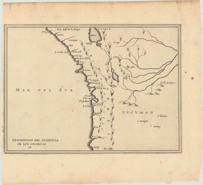
Subject: Western South America
Period: 1622 (circa)
Publication: Description des Indes Occidentales
Color: Black & White
Size:
11.6 x 8.4 inches
29.5 x 21.3 cm
An early map of the Spanish colonial possession of Los Charcas, comprising southern Peru, western Bolivia, and northern Chile. The map extends from Lake Titicaca and Arequipa to Rio de Santa Clara. The lack of detail is in keeping with the official policy of protecting Spanish knowledge in the New World. Antonio de Herrera y Tordesillas was the official historian of Spain and the Indies. He compiled a history of the Spanish conquests and early explorations in the Americas. The various editions and translations of his works are scarce.
References: Shirley (BL Atlases) G.HERR-2a #12.
Condition: B+
A dark impression, issued folding with a small vase watermark, a narrow left margins, and light, scattered foxing.


