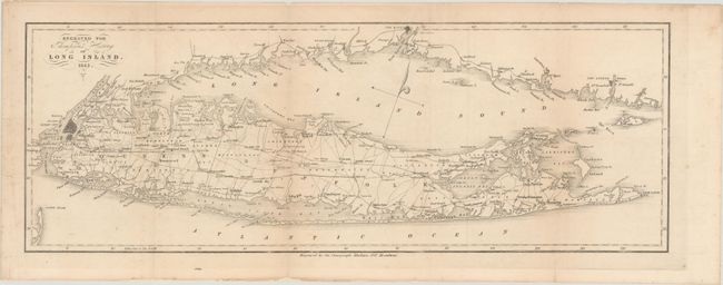
Subject: Long Island, New York
Period: 1843 (dated)
Publication: The History of Long Island
Color: Black & White
Size:
20.7 x 7.4 inches
52.6 x 18.8 cm
This uncommon map of Long Island appeared in the second edition of Benjamin Franklin Thompson's The History of Long Island. The map covers the island from Fort Hamilton to Montauk. It features excellent detail of roads, railroads, bays, inlets, and more. Manhattan is depicted in miniature plan form. Several New York City neighborhoods are named, including Harlem, Astoria, Williamsburg, Flatbush, Jamaica, and Flushing. Numerous place names appear along the Long Island Sound, including Bridgeport, New Haven, and New London. Engraved by the Omnigraph Machine.
References:
Condition: B+
Issued folding, now backed in archival tissue to repair several small chips and a 1.25" edge tear that just crosses the neatline at left. There is light scattered foxing, some faint toning, and minor extraneous creasing.


