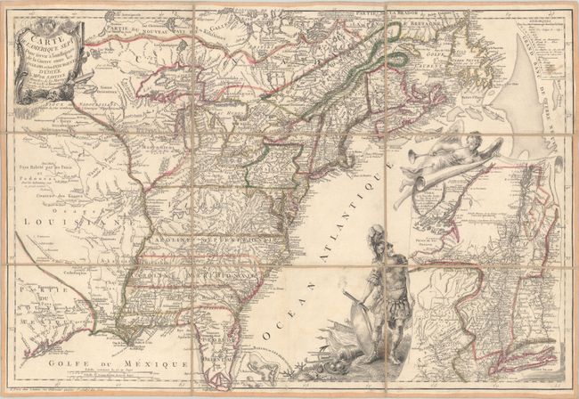
Subject: Colonial Eastern United States & Canada
Period: 1777 (dated)
Publication:
Color: Hand Color
Size:
24.5 x 16.8 inches
62.2 x 42.7 cm
This extremely rare map covers the region from James Bay to the Gulf of Mexico including southern Florida, extending west past the Mississippi River. The map was issued to illustrate the region embroiled in the Revolutionary War as evidenced by the large inset map of New York and the adjacent area, where the insurgents were battling the British in 1777. The inset is presented by Mars, the god of war, and the angel of Fame, possibly to announce France's entrance into the war on behalf of the Continental Army, which occurred a few months after the publication of this map.
The map is based on the Mitchell map of 1755 and provides great information on the settlements, forts, roads, and trails. It also provides good detail along the coasts, especially in the large fishing banks off New England and Newfoundland, and the Indian territories and villages on the western frontier. The southern colonies all have their western boundaries on the Mississippi River and Pennsylvania extends well into New York. This is the second state with updates to Lake Champlain, the upper Hudson River, and the title of the inset map. This example was issued dissected into 9 segments and backed on linen with the original printed paper label: "A Paris chez Vignon Marchand de Cartes de Geographie, rue Dauphine vis-a-vis celle d'Anjou."
References: McCorkle #777.3; Sellers & Van Ee #149.
Condition: B+
A crisp impression with contemporary outline color on a bright sheet with a couple of stains. There are a few minor cracks in the paper at far right caused by the oxidation of the green pigment, which are stable due to the linen backing.


