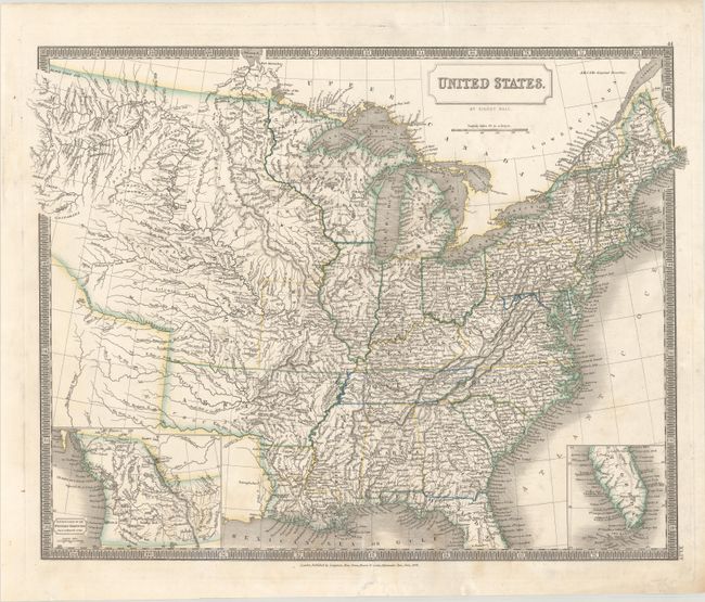
Subject: Eastern United States
Period: 1828 (dated)
Publication: A New General Atlas...
Color: Hand Color
Size:
20.4 x 15.9 inches
51.8 x 40.4 cm
This scarce and detailed atlas map includes up-to-date cartography in the American West, drawing heavily on the Lewis and Clark expedition as a source. The main map extends as far west as the headwaters of the Missouri River in present-day Montana and shows the Yellowstone and Stinking Water rivers. Arkansas Territory is at its largest configuration, incorporating present-day Oklahoma into its boundaries. The Northwestern Territory includes Michigan's Upper Peninsula, present-day Wisconsin, and part of Minnesota. The Iaways tribe is noted in present-day Iowa along with lead mines and Dubuque's tomb. Numerous Indian tribes, forts, and rivers are identified throughout the vast Missouri Territory. A huge Great Desert is noted south of the Platte River. The coverage of the map is extended by two insets in the lower corners: Continuation of the Western Territory on a Reduced Scale at left and Florida at right. The former reflects the Oregon Boundary dispute in the Pacific Northwest, depicting American claims extending to 54°40' - an unusual choice for a British cartographer. Surrounded by a keyboard border. Published in London by Longman, Rees, Ome, Brown, and Green.
References: Phillips (Atlases) #758-44; Wheat [TMW] #380.
Condition: B+
Contemporary outline color with light soiling and some edge tears mostly at bottom, including a couple that enter the map image which have been repaired on verso with old paper.


