Subject: North Atlantic
Period: 1704 (circa)
Publication: Atlas Maritimus
Color: Hand Color
Size:
22.2 x 18.6 inches
56.4 x 47.2 cm
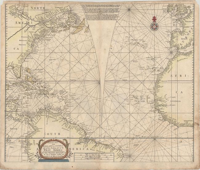
This rare chart covers the North Atlantic and the surrounding coastlines including the Eastern Seaboard of North America, the West Indies, northern South America, West Africa, and Western Europe to Ireland. Thornton utilizes a unique feature to represent distances on the chart more accurately than with Mercator's projection. Thornton adds a triangular separation in the North Atlantic, essentially separating the chart into two halves similar to how globe gores would be represented. Within this blank area, Thornton explains the "error of plaine saileing" using a "plaine chart," which surreptitiously refers to charts using Mercator's projection. He further clarifies that when measuring a distance that crosses the North Atlantic, one must subtract the area shown within the blank triangle in order to calculate the distance accurately. Thornton was known to disparage Mercator's projection on other maps and would use different projections (such as Mr. Wright's projection) to create a more precise map.
Cartographically, the map gives good detail along the coastlines with limited interior information. The coastlines are filled with place names and the names of countries and English colonies are noted in the interior. In North America, the distinct fishing banks off Newfoundland and the curious depiction of the St. Lawrence River stretching into the interior with tiny lakes in the Great Lakes region, are characteristics of Thornton's charts. A river flows southeast from the Great Lakes into the interior of North America, which connected to the Mississippi River on other charts by Thornton.
John Thornton was one of the most important English mapmakers, from the so-called Thames School of chart makers, during the period when Britain dominated mapmaking. In addition to actual chart-making he also was a publisher. He was appointed Hydrographer to the Hudson Bay Company and the East India Company. The title cartouche includes John Thornton's imprint at the Sign of England, Scotland and Ireland in the Minories, London.
This map appear to be very rare, as we were not able to locate any examples available for sale in the past 30 years, and only one institutional example in the John Carter Brown Map Library.
References: Shirley (BL Atlases) M.THOR-1c #17.
Condition: B
A nice impression printed on double-thick paper with moderate soiling, some small chips and tears along the edges of the sheet, and a centerfold separation that enters 1/2" into image at bottom.


