Subject: Pacific Ocean
Period: 1846-67 (circa)
Publication:
Color: Hand Color
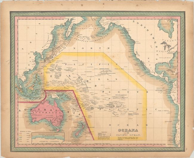
A. Oceana or Pacific Ocean, by Samuel Augustus Mitchell, from A New Universal Atlas, circa 1846 (15.6 x 12.6"). This handsome American atlas map details the Pacific Rim, spanning Indonesia, Australia and New Zealand, Japan, and Kamtschatka to Alaska and down the coastlines of North and South America. Australia is divided into only three states: West Australia, South Australia, and New South Wales. No information on Antarctica is noted, but the small inset "Wilkes' Discoveries on a Reduced Scale" shows a portion of the Antarctic coast and locates volcanic rocks. The colonial possessions are indicated by color, and the key to the map notes that the underscored islands are where missionaries have found the most success. Reference: Rumsey #0537.071. Condition: Contemporary color with light scattered foxing. There is toning and a few edge tears and chips along the edges of the sheet. (B+)
B. Map of Oceanica, Exhibiting Its Various Divisions, Island Groups &c., by Samuel Augustus Mitchell, dated 1867 (13.6 x 11.0"). This striking map of the Pacific subdivides the ocean into Malaysia, Australasia, and Polynesia. It extends to include much of North America, including the Alaskan peninsula. Within the United States the new state Oregon is identified. Australia is divided into West Australia, North Australia, South Australia, New South Wales, Victoria, and Tasmania. A plethora of small islands are named in the Pacific, but only the Hawaiian islands are shown in detail, in an inset at bottom right. Surrounded by a floral border. Condition: Contemporary color with marginal toning, otherwise very good. (A)
References:
Condition:
See description above.


