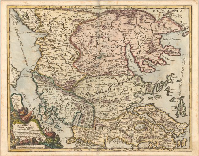
Subject: Northern Greece, Albania, & Macedonia
Period: 1684 (dated)
Publication: Mercurio Geografico...
Color: Hand Color
Size:
21.5 x 17 inches
54.6 x 43.2 cm
This handsome Italian map of northern Greece spans from Skopje south to the Golfo di Lepanto (Gulf of Corinth), including all of Albania and North Macedonia. There are many place names throughout and fine topographical detail, especially in the mountainous regions. Several islands are identified, including Corfu and Skyros. The lavish title cartouche is decorated with imagery suggesting military might and incorporates a key and distance scale. Engraved by Francisco Donia.
References: Shirley (BL Atlases) T.ROSS-1d #120; Zacharakis #543.
Condition: B+
A crisp impression on watermarked paper with light scattered foxing and a short centerfold separation at bottom.